Understanding Political Maps: A Comprehensive Guide
Everything You Need to Know About Political Maps
Political maps, physical maps, topographical maps, and even simple road maps are all distinct types of cartographic representations. A political map is often the first map children encounter, aside from fictional treasure maps, yet most people never learn the formal term for this common reference tool. In fact, many go their entire lives without understanding the differences between various map types.
This comprehensive guide will explain what a political map is, its key features, advantages, disadvantages, history, and practical applications. You'll also gain insights into when and how to use them effectively.
Among the most commonly used reference maps, political maps display the geographical boundaries that separate administrative units such as nations, states, and counties. They typically show major water features like oceans, rivers, and lakes, along with transportation networks and urban centers. Essentially, a political map represents the political characteristics of a given area rather than its physical landscape.
Political maps vary significantly in scale. Some encompass entire continents, while others focus on smaller regions like states or counties. You've likely encountered numerous political maps throughout your life, and understanding how to interpret them is essential for effective use.
EdrawMax Map Software enables you to create interactive map drawings with easy-to-edit templates. Quickly identify locations and regions with professional mapping tools.
Historically, people created maps to demarcate land borders and territorial claims. Rulers including kings and queens relied on these maps to understand their domains, determine taxation areas, identify locations for loyal subjects, and plan territorial expansions through invasion or settlement.
During periods of crisis like the Great Famine, political maps became essential tools for governance. Authorities established relief works programs that allowed people to earn wages through public works projects such as road construction. Accurate maps were crucial for determining which landlords were responsible for relief efforts in specific regions, highlighting the practical importance of precise political boundaries.
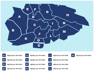
Political maps are ideal for displaying governmental borders of countries, states, counties, cities, and towns, along with major geographical features. They typically include user-friendly indexes for quick reference and are particularly useful for understanding administrative divisions and political relationships between regions.
These maps help people comprehend global geography and are often the first map type introduced in educational settings. People frequently consult them as reference charts when they need answers about political boundaries, capital cities, or administrative divisions.
Political maps serve diverse audiences by depicting national, state, county, and major city boundaries. They help identify regional socio-political patterns that influence group activities and government decision-making processes.
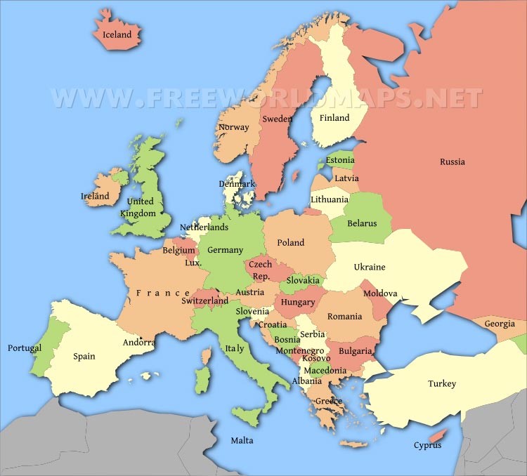
While traditionally printed on physical media, political maps are increasingly created digitally and viewed online. Millions of people use search engines daily to find political reference maps, with common searches including "United States map," "World map," "Europe map," and specific state maps like "Florida map."
Thousands of political reference maps have been created to represent United States geography at various levels—national maps, all 50 state maps, and maps of 3,142 counties (called parishes in Louisiana and boroughs in Alaska). Most counties are further divided into smaller political divisions, resulting in an extensive collection of maps just for US political geography.
Global, national, and continental political maps remain the most popular types used in educational and professional settings. They are frequently annotated with push pins, sticky notes, photos, marker flags, and strings to indicate family travels, business locations, or other significant places and events.
Want to create various map types quickly? Use EdrawMax Map Creator with pre-made templates and intuitive editing tools!
Reading a political map effectively begins with understanding your orientation relative to the information presented. Certain map elements remain consistent regardless of format—direction is the most important. North always appears at the top, south at the bottom, east on the right, and west on the left. This standardization applies to all political maps.
Once oriented, follow these steps to read the map effectively:
Below is an example of a political map of the United States of America. The US is a federal republic consisting of 50 states, one federal district (Washington, D.C.), five major territories, and several island territories. The 48 contiguous states and Alaska form North America, while Hawaii and smaller outlying areas are located in the Pacific and Caribbean regions.

This political map displays the United States and neighboring countries, the national capital Washington, D.C., state boundaries, state capitals, and other major urban centers, providing a comprehensive view of the country's political geography.
A political map distinguishes itself from other map types by emphasizing government and administrative boundaries rather than physical landscape features. It represents the abstract divisions between nations, states, territories, and cities rather than depicting the actual terrain.
This guide has covered everything you need to know about political maps, including their history, applications, benefits, limitations, and interpretation techniques.