Subway Map Software
Edraw subway map software provides an automated, all-in-one solution for transit designers. It's also the ideal tool for urban planners needing to create detailed maps of city road networks for these key reasons.
Download Free Map Software and Explore All Templates
EdrawMax
All-in-One Diagram Software
- Superior file compatibility: Import and export drawings to various file formats, such as Visio
- Cross-platform supported (Windows, Mac, Linux, Web, Android, iOS)


System Requirements
Compatible with Windows 7, 8, 10, XP, Vista, and Citrix
Supports both 32-bit and 64-bit Windows systems
Runs on Mac OS X 10.11 or later
Powerful Subway Map Software Features
- Drag-and-drop functionality with extensive shape libraries featuring over 8,000 vector elements for dynamic diagram creation
- Intuitive point-and-click editing capabilities for precise shape customization
- Flexible layout options with comprehensive import/export support (PDF, SWF, JPG, GIF, BMP, and HTML image maps)
- Accelerate your workflow with professionally designed templates and practical examples
- Extend beyond subway maps with capability to create over 200 different diagram types
- Premium Customer Support: At Edraw, we're passionately committed to your satisfaction. While we strive for flawless performance, our dedicated team ensures rapid resolution for any issues.
Key Benefits of Using Professional Subway Map Software
- Utilize Google Maps as direct reference for accurate geographical context
- Follow exact city blocks and road layouts from Google Maps to create professionally redrawn maps with customized color schemes
- Generate print-ready maps with official-quality colors suitable for publications and promotional materials
- Create comprehensive maps covering both specific segments and entire city blocks with full-color representation
- Easily revise and update maps as urban infrastructure evolves
- Complete customization of map dimensions, line weights, and color palettes
- Seamless Third-Party Integrations: Effortlessly connect with Microsoft programs for enhanced workflow efficiency
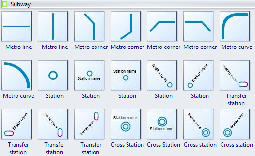
Comprehensive Subway Map Symbols Library
Access numerous professional subway symbols including metro lines, corners, stations, transfer points, cross stations, and more
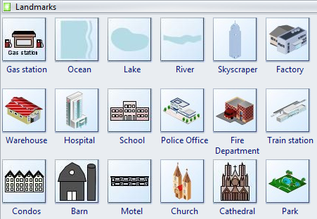
Extensive landmark icon library featuring gas stations, restaurants, hospitals, schools, community offices, libraries, and more. Learn how to design professional subway maps in minutes.
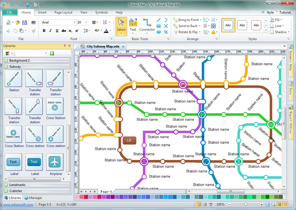
City Subway Map Template
Try this professional city subway map template. Experience its intuitive workflow and rapid adoption for your transit design projects.
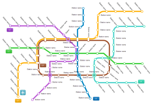
Shenzhen Metro Map Example
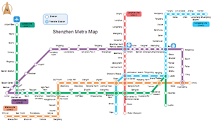
This example showcases the 2015 Shenzhen metro map, demonstrating Edraw's capability to produce high-quality, professional subway maps.